Published on September 20, 2025
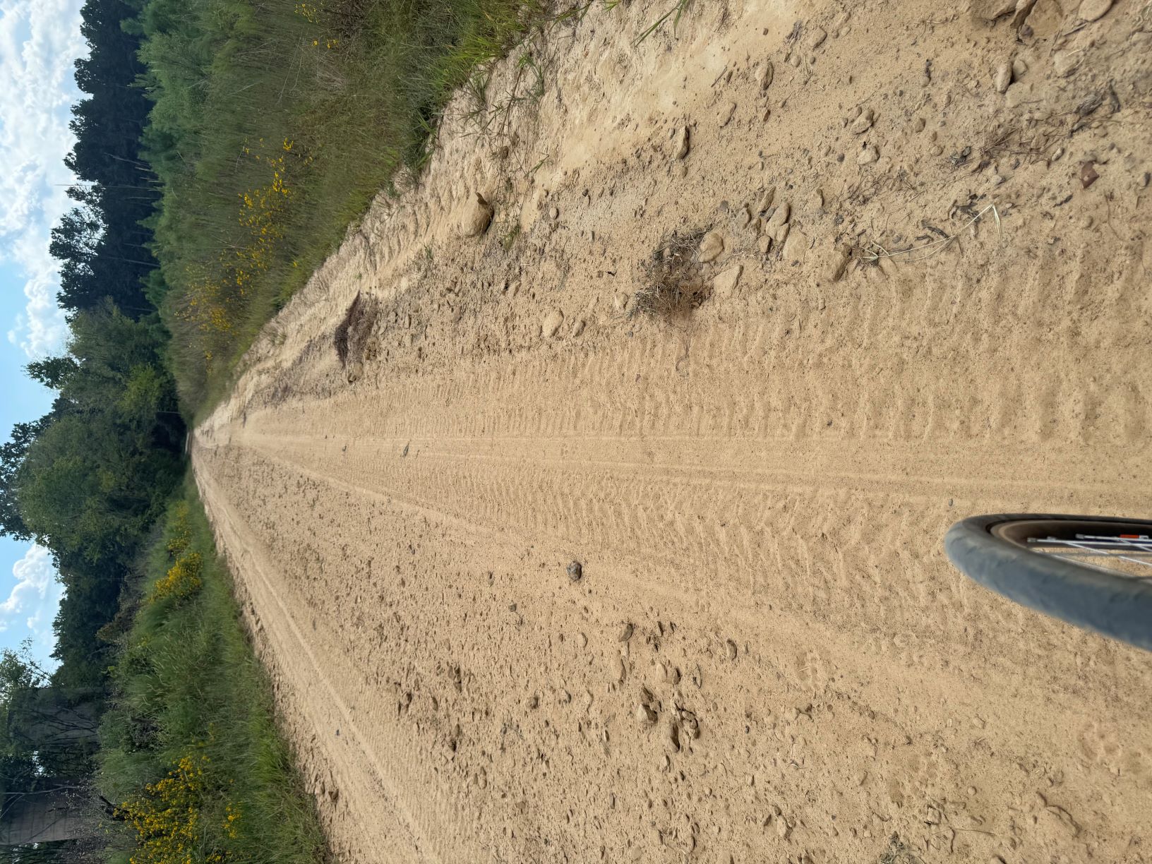
So on my ride across America many years ago cellphones and google maps did not exist. I called my parents every Saturday to let them know I was ok and I used old fashion folding maps to find roads that were not Interstates that were both scenic and effecient routes for me to follow. Well now all these years later I can ask google maps to find options for me to peddle from one city to another. Unfortunately there is no option to exclude unpaved roads like the picture in this blog and these unpaved roads have really screwed up my last 2 days in terms of losing valuable recovery time because I am riding longer and expending more energy to stay upright on them. So I am trying figure out a way to make a hybrid model of route planning that uses the best of both. It is a reminder of how important clear directions are and the importance of double checking their accuracy and your understanding of their limitations! WHO DAT frustrating but I persevere!